Decoding the City’s DNA Through Its Subsurface Stratigraphy
Newcastle upon Tyne is a Palimpsest. The city’s most important architecture is not the sweep of Grey Street or the industrial grandeur of the Tyne Bridge, but what lies below your feet. Every foundation trench dug in Newcastle cuts through layers of deliberate burial, violent erasure and pragmatic adaptation, and in doing so it exposes the true nature of the city. The real narrative of Newcastle is stratigraphic, a vertical story of power, commerce and expediency, written in stone, earth and water.
This is not a metaphor. Newcastle’s subsurface is a physical archive of exceptional complexity, where Roman masonry supports medieval fortification, where Victorian railway tunnels pass through plague pits, where culverted burns still flow under dual carriageways and where 21st Century development must negotiate the archaeology of two millennia. The character of this city, its grit, its industrial pragmatism, its multi-layered identity, is encoded not in what it has constructed above ground but in what it has systematically buried, repurposed and built upon. To know Newcastle, is to excavate it.
The Keep over the Wall: Pons Aelius under Newcastle’s Castle Keep
We must start with an act of architectural erasure. In 1168, Henry II’s master mason and his workmen stood on an elevated promontory above the Tyne’s lowest bridging point and began to construct the Newcastle Castle Keep. Beneath their feet was not empty ground but the site of a substantial Roman fort, known as Pons Aelius, which had been established by the emperor Hadrian’s army in AD 122 to serve as the eastern anchor of the great wall bearing his name. It was a site chosen by the Normans for the same reasons the Romans had chosen it, and the foundation they laid was both a literal and a symbolic act of erasure and overwriting.
We know that the Normans did not simply reuse the site because the foundations of the Keep were excavated to a depth that would reveal the Roman substructure in any modern ground investigation. The Keep’s Norman stone foundations incorporated Roman masonry, not out of need, for there was ample local stone, but because the Normans were proud of their work and wanted to signal its continuity with the past. The Keep’s western wall used many reused Roman dress stones, still bearing evidence of the masons that shaped them for Hadrian’s army. Many of these stones were inverted, recut and embedded in the Norman walls. The Normans were saying, with a pride and permanence of which we have long since lost the knack: we are the new Rome and we build our strength directly on yours.
Archaeological excavations at the Castle have shown the depths to which this overwriting went. The Roman fort’s principia (headquarters building) was almost entirely under the footprint of the Keep. Some of the Roman walls were truncated, their upper courses robbed for the construction of the Keep whilst their lower courses were left in situ to form a foundation for the new Norman structure. The principia’s footprint was literally stratified, a palimpsest of power with a vertical history written in stone. If a modern architect in Newcastle were to undertake a ground investigation in the Castle precinct, they would encounter this palimpsest in its most literal sense: Norman foundations, abutting on Roman foundations, with medieval modifications to both of them, and with a layer of “restoration” by Victorian building operations.
The Pons Aelius itself, the Roman bridge that gave the fort its name, has never been conclusively located, though its abutments almost certainly lie beneath the medieval bridge and the later iron and stone arches. Ground-penetrating radar surveys in the 1990s have suggested the presence of significant masonry structures in the river bed to the downstream of the Swing Bridge, but the level of heavy silting and the fact that the medieval, later 19th Century and modern bridges are all built on the same river alignment have created an archaeological conundrum that is not likely to be resolved any time soon. The bridge like so much of Newcastle’s buried infrastructure exists now in a largely subterranean state, its precise form open to scholarly debate but its influence on the city’s development unimpeachable.
It was this pattern of overwriting, of building directly on the ruins of what had gone before, that established the template for the next two thousand years of Newcastle’s development. Each new layer of power and authority, Norman, medieval, Tudor, Georgian, Victorian, Modern would build not around but directly over what had gone before, the foundations of a vertical city of extraordinary stratigraphic complexity.
Palimpsest II: the Burial of the City’s Burns
If the Castle represents Newcastle’s act of architectural overwriting by fiat, the city’s burns, the Lort Burn and Pandon Burn, represent a more gradual but no less profound erasure, the burial of the natural landscape beneath the pragmatism of industrial and commercial growth.
The Lort Burn was not a minor stream. Rising in what is now Jesmond, the Lort Burn flowed through the Haymarket, down into the valley that became Dean Street, into the Tyne at the foot of what is now Castle. The Pandon Burn flowed on a roughly parallel course to the east, defining the edge of medieval Newcastle and flowing through what became the west of the Ouseburn valley. The two burns shaped the city’s topography, creating the deep valleys and long high ground that still make Newcastle’s landscape so striking.
Medieval Newcastle did not “solve” the Lort and Pandon Burns. It worked with them. The Lort Burn was bridged at multiple points along what is now Pilgrim Street and Dean Street, the latter of which takes its original name from those bridges. Mills were built along its course. It was a boundary, a source of water for brewing, tanning and other processes. It was woven into the city’s fabric, visible and acknowledged.
The 19th Century saw it all change. As Newcastle industrialised and its population grew from just over 28,000 people in 1801 to more than 215,000 in 1901, the burns became something to be solved rather than managed. They flooded. They became polluted with industrial and human waste. They occupied valuable land in a city desperate for space and, most critically, they got in the way of the railways.
The Lort Burn was culverted piece-meal throughout the 19th Century but the most significant phase of this process took place in the 1830s and 1840s with the construction of the Newcastle and Carlisle Railway. The railway’s approach to Newcastle Central Station needed to be on a level route, a straightforward proposition to the south and west of the station but requiring the crossing of the Lort Burn valley, at that point at the bottom of what is now Castle. Rather than bridge the valley, an expensive and technically difficult proposition, the engineers buried the burn, constructing a brick-lined culvert and building the railway on top of the infill.
Dean Street, built in 1835, is the street that shows this process most clearly. Running along the valley of the Lort Burn in a way that the pre-existing network never had, its unusual width and gentle curve reflect the sub-surface topography. Beneath the road surface the Lort Burn still runs, in a Victorian culvert, a brick-vaulted tunnel large enough to walk through, carrying not just the flow of the Lort Burn’s original course but the combined drainage of a significant part of central Newcastle. Any architect designing a development on Dean Street or its tributaries needs to take account of this hidden watercourse, of the need to ensure that foundations don’t compromise the culvert’s integrity and of the need to design a drainage system that can cope with the burn’s periodic flooding.
The Pandon Burn had a similar story. Its burial, more or less complete, was driven by the railway’s need to access the goods yards built by the North Eastern Railway in the west of the city and the approaches to the High Level Bridge. By the 1850s the burn had been culverted from source to mouth, its valley filled and built on top of. Today, it runs from its source near Gosforth on a course now mostly beneath City Road, the Ouseburn Valley and, finally, beneath Northumberland Road, its presence only marked by the occasional manhole cover and the occasional subsidence issue in buildings that straddle its route.
The burial of the burns created what we might call Newcastle’s first truly subsurface infrastructure, not cellars and foundations but engineered voids designed to carry water through the city unseen. The culverts are significant structures, some of them large enough to require periodic maintenance by crews who enter them in small boats. They are a Victorian confidence in the power of engineering to remake nature, to literally bury the landscape and build something new on top of it.
Buried watercourses don’t go away. They still flow, they still flood, they still exert a pull on the ground above them. Any architect in Newcastle undertaking a major new development has to commission hydrological surveys to understand where these hidden streams run, to know that the ground beneath Newcastle is not a solid mass but a perforated surface, that water still has its own routes and reasons, that a city’s most significant buried asset is still there, still holding life above it in place, still occasionally making its presence felt in a flood or a subsidence claim.
Newcastle’s Hidden Layer: Tunnels, Vaults, and the Victorian Subterranean City
The Victoria Tunnel is the most famous of Newcastle’s underground structures, and it is easy to see why. Constructed between 1839 and 1842 as a transport route to bring coal from Spital Tongues colliery to the Tyne, it is a 2.4-mile-long brick-lined passage tunnel running from the north of the city under a succession of streets and tenements to a river basin on the east side of the Tyne. Closed after the last coal shipment in 1862, it was later used as an air-raid shelter during the Second World War and was opened to the public in recent years as part of a bid to connect visitors with the hidden history of the city.
The Victoria Tunnel is just the most accessible part of a much more substantial Victorian subterranean city. Running for miles below the streets of central Newcastle and stretching north under the Team Valley and east past the Quayside are a network of vaults, arches, tunnels, chambers, undercrofts, and undercrofts under undercrofts. A shadow infrastructure that supported industry, transport, commerce and the movement of goods through the city in three dimensions. These structures were never conceived as a single entity but instead built piecemeal to solve immediate problems, leaving their complex three-dimensional form being slowly explored and mapped by modern engineers and archaeologists.
The railway viaducts and arches are probably the most substantial part of this shadow infrastructure. The approaches to Newcastle Central Station required huge earthworks to create a level route for trains through the city’s hilly streets. In particular, the Victorian engineers refused to create solid embankments or walls where it was possible to create vaulted arches instead. Hundreds of these arches were left below street level in many of the approaches to the station and along the Forth Street cutting, a subterranean city of vaults that could be used as storage spaces, workshops, and warehousing.
Hundreds of these arches have been converted to modern uses such as workshops, nightclubs, storage, and even restaurants, and are in regular use. But dozens more are bricked off or completely undocumented and forgotten, and whenever a new development is proposed on the streets around the station or the Quayside, ground investigations routinely discover unknown arches, vaults, and tunnels. The Victorian railway infrastructure created a city of voids and chambers below street level that underlies every modern development in the area.
Coal drops and staithes along the Tyne created a second level of subsurface infrastructure. Coal was mined in the Northumberland and Durham coalfields and brought by rail to Newcastle before being transferred to ships for transport to the continent and north of England. To manage this process, complex systems of drops, chutes, and underground conveyors were built in the nineteenth century. These structures extended both above and below ground, with tunnels and chambers cut into the riverbank to allow coal to be tipped from railway wagons down to ship holds by gravity. Most of these structures were demolished in the twentieth century, but their footings and tunnels remain, leaving voids and weak ground that often affects riverside development.
Commercial buildings added yet another level of subsurface infrastructure. Victorian warehouses around the Quayside and Close were built with deep cellars and sub-cellars, sometimes extending for multiple levels below street level. These spaces were more than just storage, and many were highly engineered environments with their own access routes, ventilation systems, and structural logic. A network of tunnels connected some of these below-ground spaces to one another, allowing goods to be moved without using the already congested street above.
Many of these cellars were built into even older structures. Archaeological investigations into former breweries on the Side and Close have revealed medieval undercrofts, and even possible Roman structures underneath, creating a stratigraphic sequence of cellars built on top of cellars, each generation digging deeper and making use of what they found. In many cases, when these buildings were demolished—as many were in the twentieth century—these cellars were simply capped off and filled with demolition material rather than excavated and recorded, creating voids and weak ground that have to be managed by modern construction.
In this sense, the Victorian subterranean city was functional, pragmatic and generally unplanned. Built for immediate need rather than as part of a grand vision, it was an infrastructure that was never systematically mapped or documented. It means that for modern architects in Newcastle, the city centre must be treated as an archaeological site. Any proposed development must begin with the understanding that the ground beneath may contain voids and structures—vaults, tunnels, culverts, or other weak ground—that must be taken into account in foundation design and construction methodology.
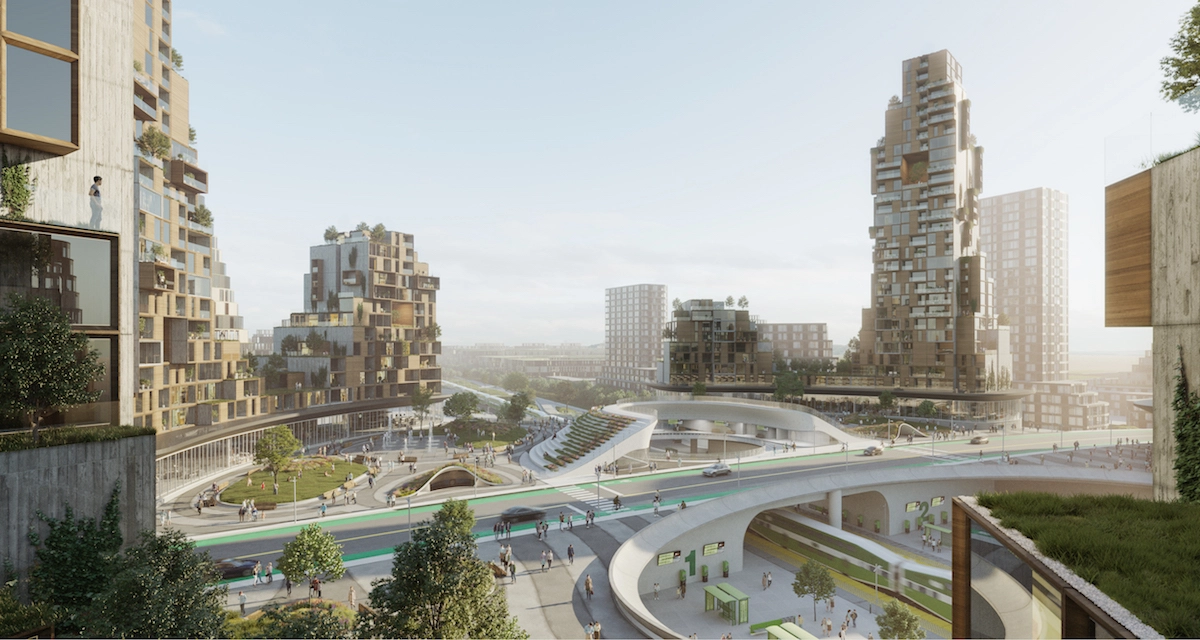
Engineering the Palimpsest: The Newcastle Helix and Modern Stratigraphy
The Newcastle Helix is a bold example of contemporary architecture in Newcastle and the city’s flagship science and innovation district. The development, which replaced the former Scottish & Newcastle Breweries complex on the Quayside, is built on ground that has been continuously built upon and occupied since the medieval period at the very least, with archaeological evidence of Roman activity and even natural watercourses adding further layers of complexity.
Ground investigations for the Helix revealed a stratigraphic sequence of extraordinary depth and complexity. At the deepest levels were natural boulder clay and river gravels. Above that were possible Roman features, though so disturbed by later activity that they could not be positively identified. Medieval and post-medieval layers, including evidence of agricultural activity and early industrial use. Victorian brewery structures, with their deep cellars, wells, and drainage systems. Twentieth-century modifications and additions. And throughout, the buried course of a tributary of the Lort Burn, culverted but still flowing.
The engineering approach to this complexity illustrates how modern Newcastle architects and engineers must negotiate with the city’s buried history. Rather than attempting to excavate to natural ground—which would have required removing up to eight metres of archaeological and historical deposits across the site—the Helix developers adopted a variety of foundation strategies tailored to the specific subsurface conditions in each individual building plot.
Some buildings used piled foundations, with concrete or steel piles being driven through the historical layers to bear on the natural boulder clay beneath. This approach minimised disturbance to the archaeological deposits, whilst providing secure foundations, but it required careful design to avoid damaging buried culverts or vaults. Other buildings used raft foundations, spreading their load across the historical deposits and accepting some settlement as the ground consolidated. This approach is cheaper but requires careful monitoring and can only be used where the historical deposits are relatively stable.
The biggest challenge in every case is water. The buried watercourses, combined with groundwater flowing through the permeable historical deposits, creates a dynamic hydrological environment that must be carefully managed. The Helix developments all included sophisticated drainage systems, designed to intercept groundwater, manage surface water, and ensure that the buried burns could continue to flow without affecting building foundations. This requires ongoing monitoring and maintenance—the subsurface hydrology is not a problem that can be solved once but an ongoing condition that must be managed.
The same challenges apply to every major central Newcastle development. The Stephenson Quarter, built on the former railway goods yards, had to manage with buried railway tunnels, coal drops, and a culverted Pandon Burn. The Stack, a leisure development in the Pilgrim Street area, sits on top of the buried Lort Burn and required extensive foundation work to ensure stability. The proposed redevelopment of the Gateshead Quays must take account of centuries of riverside industrial activity, with buried staithes, wharves and myriad unknown voids complicating every foundation design.
This is a technical challenge but a philosophical one, too. How should contemporary architecture engage with this buried past? Should developments attempt to reveal and celebrate the subsurface archaeology, as the Victoria Tunnel project has done? Should they simply engineer around it, treating the historical layers as ground conditions to be managed rather than heritage to be interpreted? Or should they attempt some synthesis, acknowledging the palimpsest but building the next layer?
Different projects have taken different approaches. The Great North Museum incorporated archaeological remains into its basement displays, making the subsurface visible and interpretable. The Castle Keep’s recent conservation works have exposed and explained the Roman and medieval stratigraphy, turning the building into a three-dimensional diagram of Newcastle’s layered history. Other developments have built over and around the archaeology, preserving it in situ but leaving it buried and uninterpreted.
There is no single right answer. What matters is that architects in Newcastle must understand that they are building not on a blank slate but on a palimpsest, that every new structure they create is in dialogue with what lies beneath, and that the character of the city is as much defined by what is buried as by what is visible.
Conclusion: Reading the Deep Map
Newcastle’s true architecture is stratigraphic. It is not inscribed on the horizontal plane of streets and facades but in the vertical dimension of layered time, where Roman stones underpin Norman walls, where Victorian tunnels cut through medieval deposits, where buried burns still flow under modern roads, and where every new foundation must be negotiated with centuries of accumulated history.
This is not a feature unique to Newcastle; every old city is a palimpsest to some degree. But Newcastle’s particular history of industrial intensity, its dramatic topography, its strategic importance, and its continuous occupation have created a subsurface of unusual complexity and density. The city has been built, demolished, and rebuilt so many times, with such intensity and such pragmatism, that its ground is less a stable platform than an archaeological archive, a physical record of erasure and adaptation.
To understand Newcastle is to read this deep map, to recognise that the Castle Keep is not just a Norman building but a Roman fort overwritten, that Dean Street is not just a Victorian road but a buried valley, that the railway arches are not just infrastructure but a shadow city, and that every modern development is not a new beginning but the latest chapter in a story written in stone, earth, and water.
For Newcastle architects and engineers, this understanding is not academic but practical. Every design must begin with an investigation of what lies beneath, every foundation must be engineered to accommodate the buried past, every development must decide how to engage with the palimpsest. The subsurface is not a constraint but a context, not a problem but a condition that defines what Newcastle is and what it can become.
The city’s character – its resilience, its pragmatism, its layered identity – is encoded in this subsurface stratigraphy. Newcastle has survived and thrived not by preserving its past in aspic but by continuously adapting it, by building upon and into what came before, by treating history not as something to be protected from change but as a foundation for it. The palimpsest is not a record of loss but of continuity, not of erasure but of accumulation.
To decode Newcastle’s DNA is to excavate it, layer by layer, understanding that each stratum represents not just a historical period but a way of building, a relationship between past and present, a philosophy of urban development. The city’s true narrative is written beneath its streets, in the complex, often violent layering that defines its character more than any single building. This is Newcastle’s deep map, and it is still being written.